Here’s a list of selected soft-field runways available to the public in Washington state. Airports participating in Fly Washington Passport stamp are listed in bold. Runway surface is “TURF” unless otherwise indicated.
| Region | Airport | ID | Runway length | Elevation |
|---|---|---|---|---|
| Northwest | Bandera State | 4W0 | 2344 x 100 | 1636 |
| (Southwest) | Cedars North | W58 | 1960 x 50 | 275 |
| Olympic | Copalis State1 | S16 | 3560 x 150 (SAND) | 01 |
| (Eastern) | Cross Winds2 | C72 | 3800 x 125 (DIRT) (13L – 31R) | 2150 |
| (Eastern) | Cross Winds2 | C72 | 2065 x 50 (DIRT) (13R – 31L) | 2150 |
| South Central | Easton State | ESW | 2640 x 100 | 2226 |
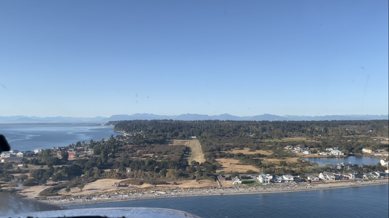
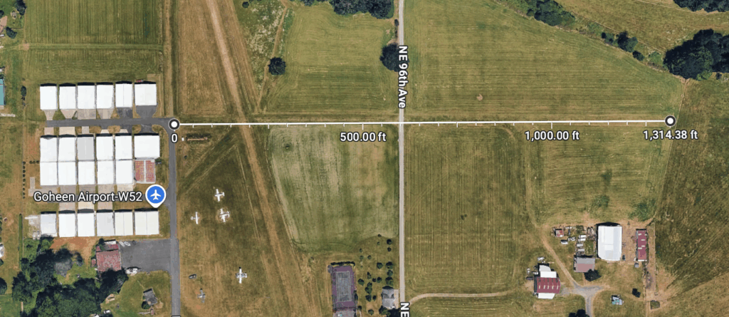
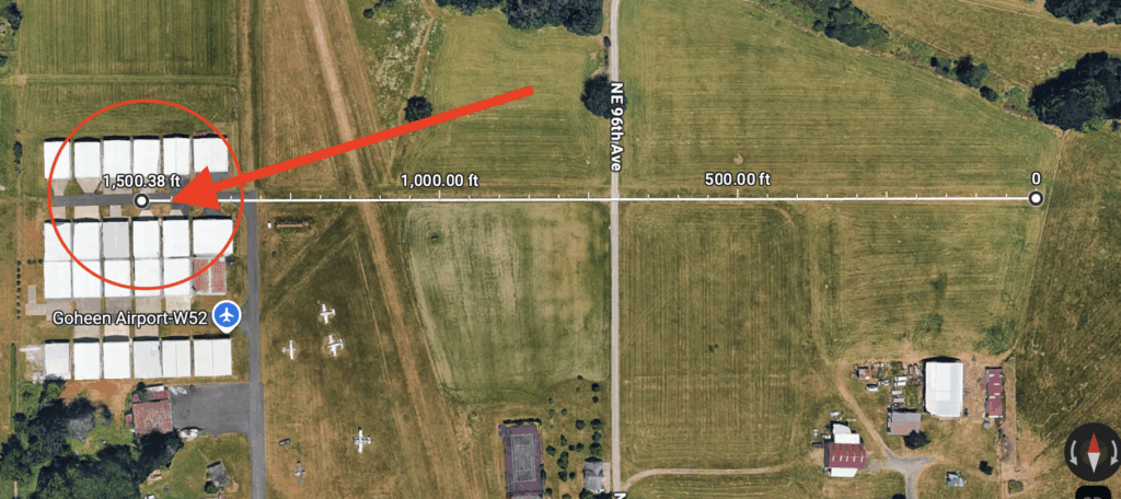
| Southwest | Goheen | W52 | 2565 x 50 (15-33) | 292 |
| Southwest | Goheen | W52 | 13149 x 48 (7-25) | 292 |
| Northwest | Harvey Field3 | S43 | 2430 x 100 (15R-33L) | 23 |
| (Olympic) | Hoskins | 44T | 2015 x 116 | 213 |
| North Central | Lake Wenatchee State4 | 27W | 2473 x 100 | 1935 |
| Eastern | Little Goose Lock and Dam | 16W | 3500 x 50 (GRVL) | 681 |
| North Central | Lost River5 | W12 | 3150 x 85 | 2415 |
| Eastern | Lower Granite State | 00W | 3400 x 50 (GRVL) | 719 |
| South Central | Lower Monumental | W09 | 3300 x 50 (GRVL) | 813 |
| Northwest | Point Roberts6 | 1RL | 2265 x 125 | 11 |
| (Olympic) | R&K Sky Ranch7 | 8W9 | 2480 x 35 | 149 |
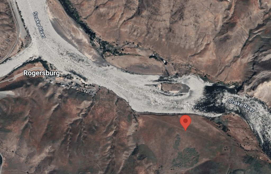
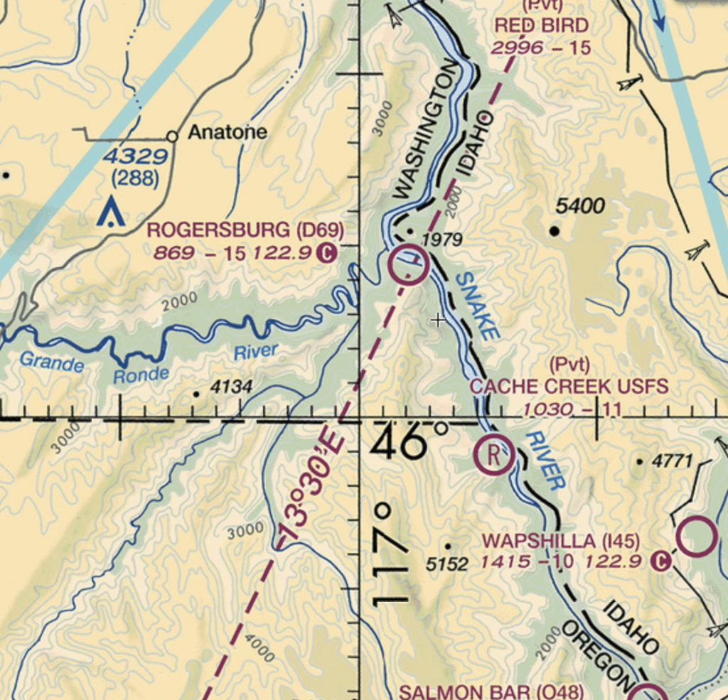
| (Eastern) | Rogersburg8 | D69 | 1471 x 50 | 869 |
| Northwest | Skykomish State4 | S88 | 2050 x 100 | 1002 |
| North Central | Stehekin State4 | 6S9 | 2630 x 100 | 1230 |
| Eastern | Sullivan Lake State4 | 09S | 1765 x 100 | 2614 |
| South Central | Tieton State4 | 4S6 | 2509 x 100 | 2964 |
| Northwest | Vashon Muni | 2S1 | 2001 x 60 | 316 |
1runway is on unimproved beach.
2Crosswinds only open to ski-equipped aircraft
3turf runway 15R-33L only open in summer months.
4Lake Wenatchee State/Skykomish/Stehekin/Sullivan State/Tieton Closed 1 Oct to 1 June
5Lost River Closed 1 Nov to 1 April
6Text for prior permission, little parking, landing/overnight fee
7R&K Sky Ranch displaced thresholds 327′ Rwy 34 and 700′ Rwy 16
8Airport closed indefinitely per Chart Supplement
91500 published is disputed by the author: Utilizing runway 7-25 includes crossing a public road (NE 96th Ave) and from starting directly at the hangars, Google Maps measures only 1314 feet as in the graphic below:
My visits to Washington soft fields:

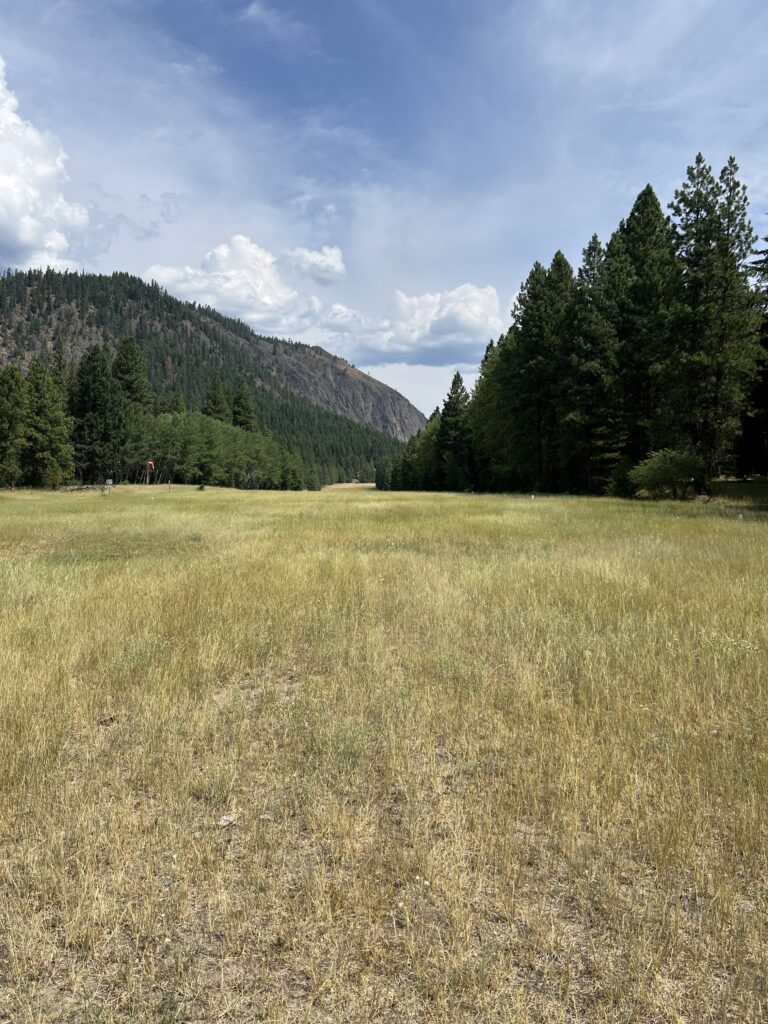
Musings on soft fields of Washington