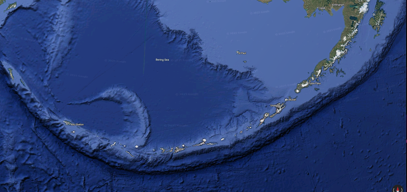
I love looking at Google Earth satellite images of far-away and remote places and dream about what it would be like to explore these isolated corners of the earth. Here are some musings about aviating in the Aleutian islands of Alaska.
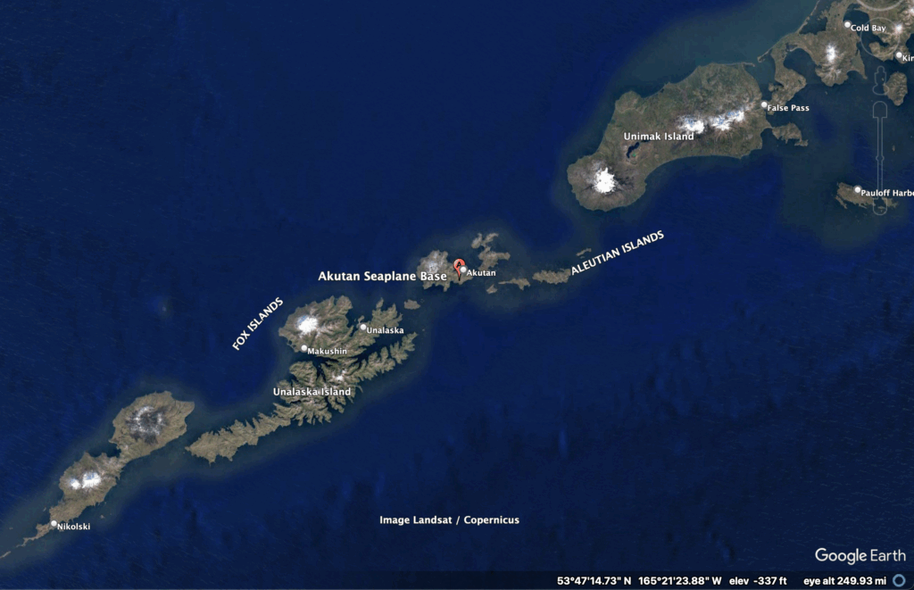
Akutan
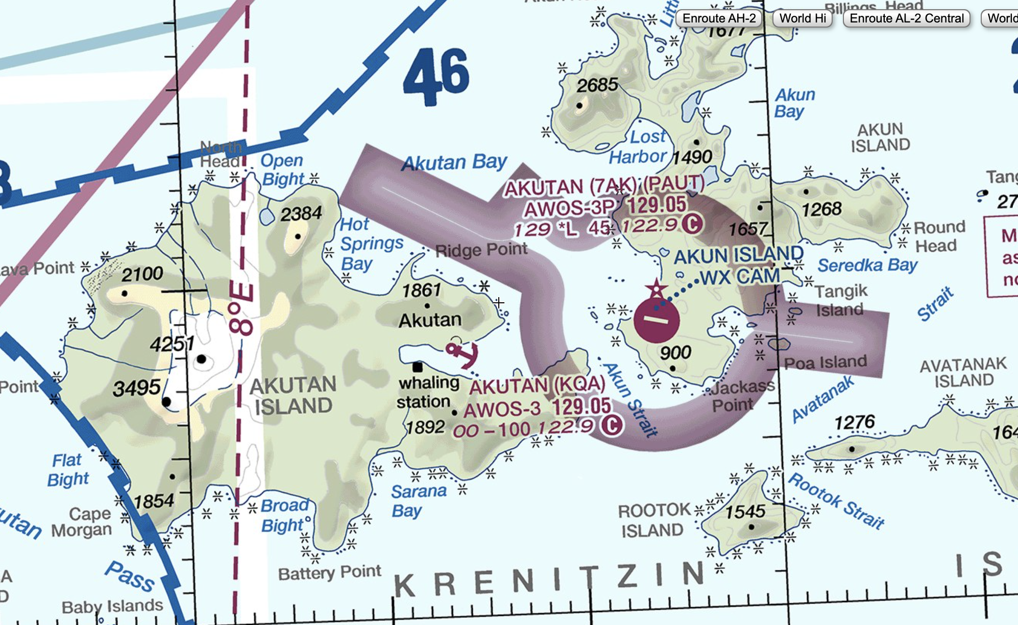
KQA Akutan Seaplane Base and the relatively new 7AK Akutan airport as published on the Sept 2025 Dutch Harbor FAA sectional chart. So new in fact the most recent satellite image I could find shows no trace of the airport.
Akutan is a small fishing village, population ~1500 in the Aleutian islands northeast of Dutch Harbor. PenAir previously provided service to Akutan via Grumman Goose, but after that service was retired, a paved runway was built on adjacent Akun Island, and now the public seaplane ramp serves as a helicopter landing pad.
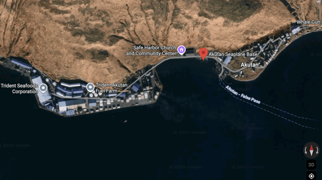
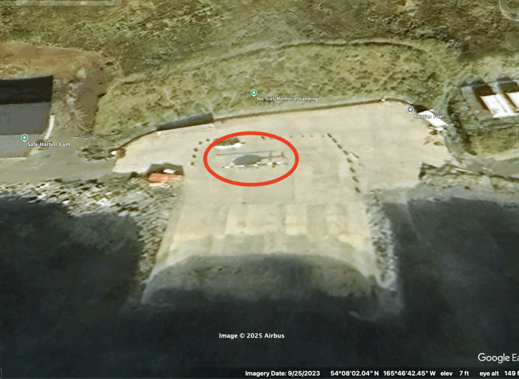
Satellite view of Akutan, AlaskaIn this September 2023 satellite image, a shadow of a light helicopter (likely a Maritime Helicopters Bell 206) is seen on the seaplane ramp.
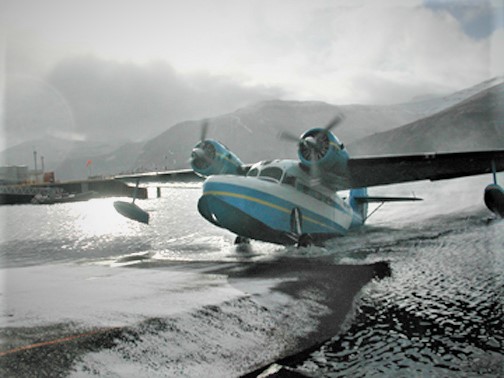
Here’s a photo I found on Wikipedia of a Grumman Goose using the seaplane base in 2005.
From the photographer: I took this picture Pabobfin 06:27, 24 March 2006 (UTC) This is a PenAir (Alaska) Goose climbing out of Akutan bay in the winter of 2005. Our company, OTG Adventures Inc. places us as physician assistants, and this is one of the places we work. Enjoy! In 2013, a new airport opened on Akun and now a hovercraft services Akutan, though less regularly. P.S. Flying in this Goose is such fun, and to think there are so few left!
Attu
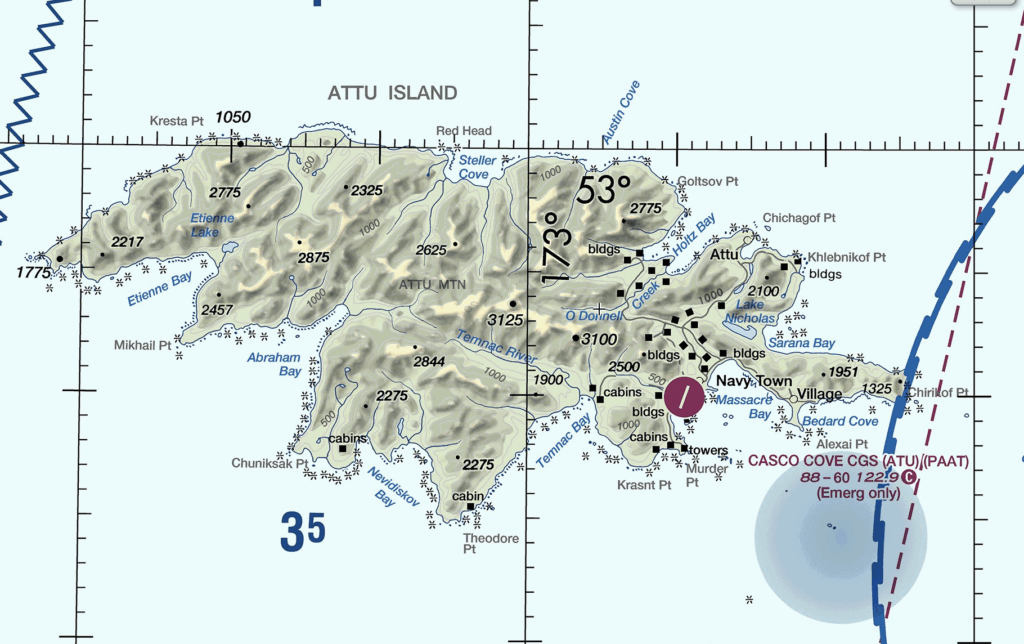
Attu is at the western end of the Aleutians and is the site of a WW2 battle with the Japanese. An airport ATU “Casco Cove CGS” was maintained on Attu until the Coast Guard closed the LORAN station there in 2010. Currently, the airport is listed as “Emergency Only” on the September 2025 sectional chart.
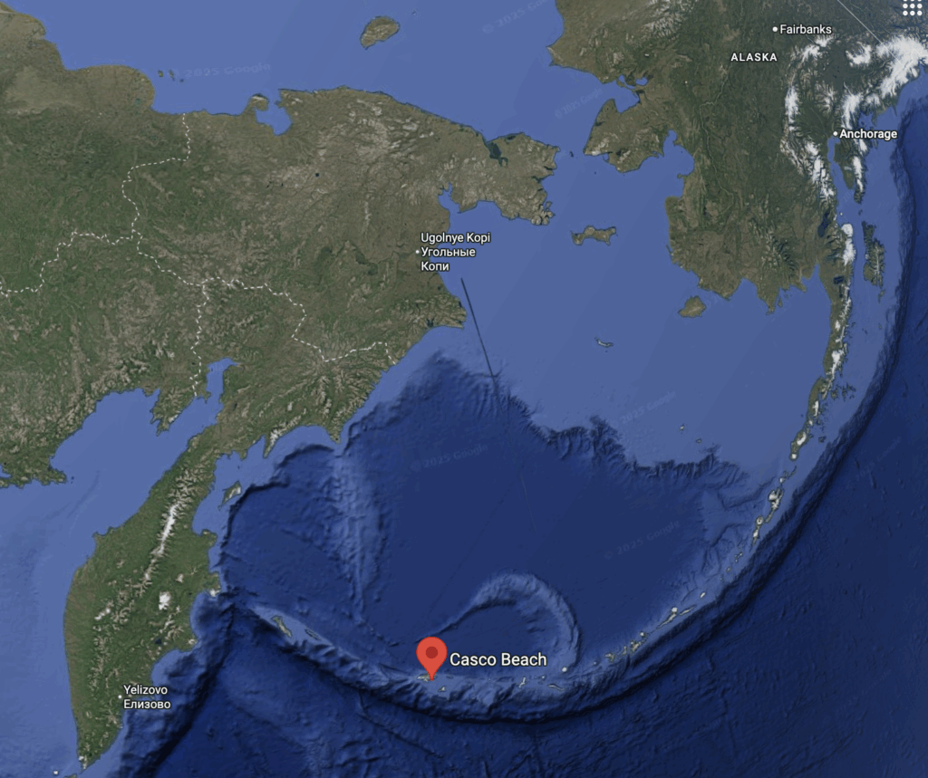
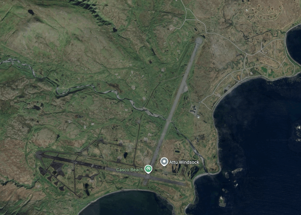
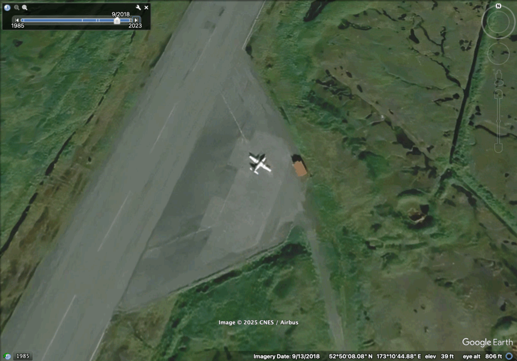
Casco Beach on Attu Island isn’t close to anything. Casco Cove CGS (ATU) airport as depicted (Emergency Only) on the September 2025 Western Aleutian Islands FAA sectional chart.In this September 2018 satellite image of ATU, a light twin aircraft is visible in the parking area near Attu station. Only the N/S runway has been in contemporary use. A light twin is visible in this 23 September 2018 image of ATU and the last evidence I can find of the runway being used, as well as the only photo period that Google Maps has available that show any aircraft at this airport.
Attu must have been a crazy place to be stationed, especially in recent times as you’d likely be the only people on the island for weeks on end. After I mentioned Attu to my father-in-law, who was a Coast Guard Corpsman stationed in Kodiak, I learned that he relieved a soldier on Attu for two weeks. Wow!! So cool!!!
Amchitka
Amchitka served as an Army/Air Force Base from the early 1940s until it was abandoned decades later.
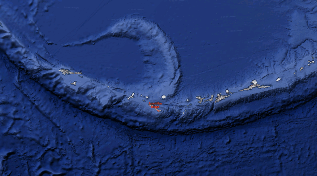
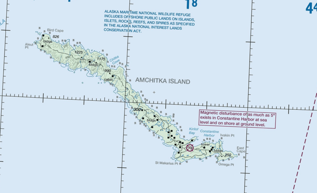
Amchitka lies between Adak and Attu in the Aleutians. Enough A’s for you??2 October 2025 FAA chart showing Amchitka as a closed/abandoned airfield. Three runways and a road network are visible in this 2024 satellite image. In this closer view of the main runway at Amchitka, a light twin is visible at left, and the runway has been cleared of moss/debris – note how brown the runway is at the edges of this photo are compared to the center, and is much clearer than the 2018 photo. I wonder if this is the same light twin seen at Attu above. I read online that there are contractors here doing environmental clean up work.
No equipment is visible in this 11 July 2018 photo, compared to the 3 June 2024 image on the right.Those appear to be shipping containers. How did they get there??
Read about the history and see historic photos of the Army, then Navy, then Air Force station at Amchitka here: Abandoned and Little Known Airfields.
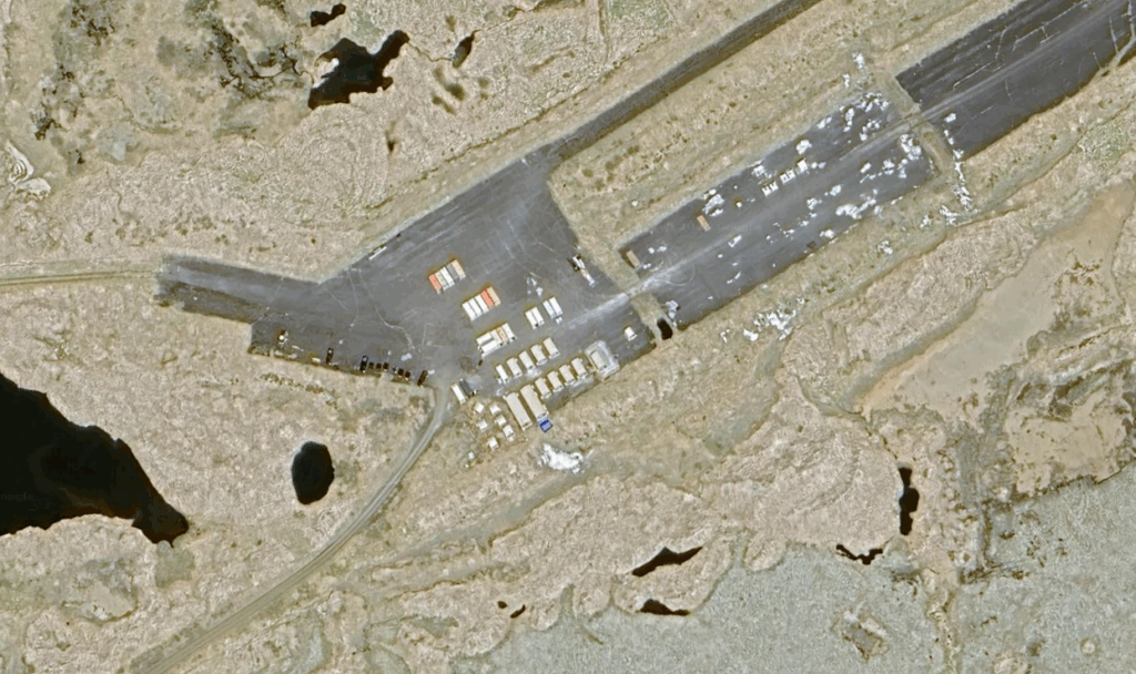
Sheyma Island – Eareckson Air Station
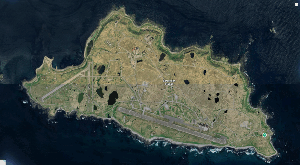
Just east of Attu Island is the active Eareckson Air Station on Sheyma Island, which is also a former WW2 air base.
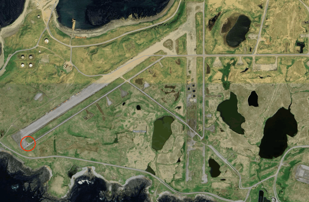
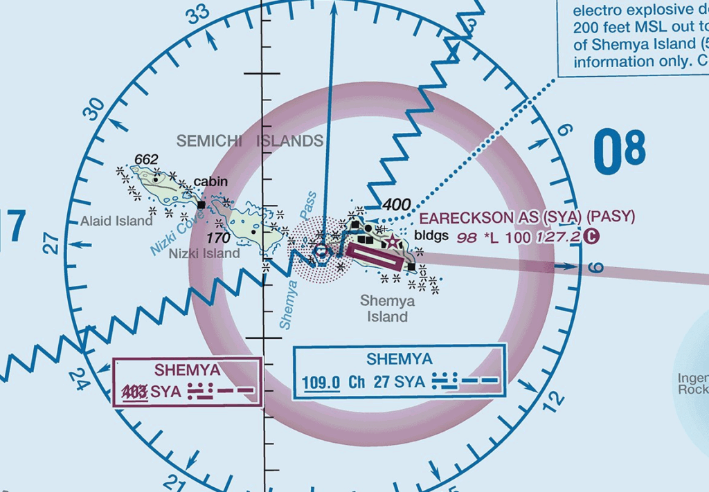
The current active runway is visible on the south side of Sheyma Island, and the abandoned portions are visible to the west. Although the north-south runway is overgrown and in disuse, this recent satellite shows equipment along the cleared western runway and the VORTAC circled at bottom left, and the dock visible in the bay at top left is new since 2018. 2 October 2025 FAA chart depicting an active Eareckson Air Station (SYA) with a VORTAC located at the west end of the island. This is currently the “western-most” American presence in the Aleutians.
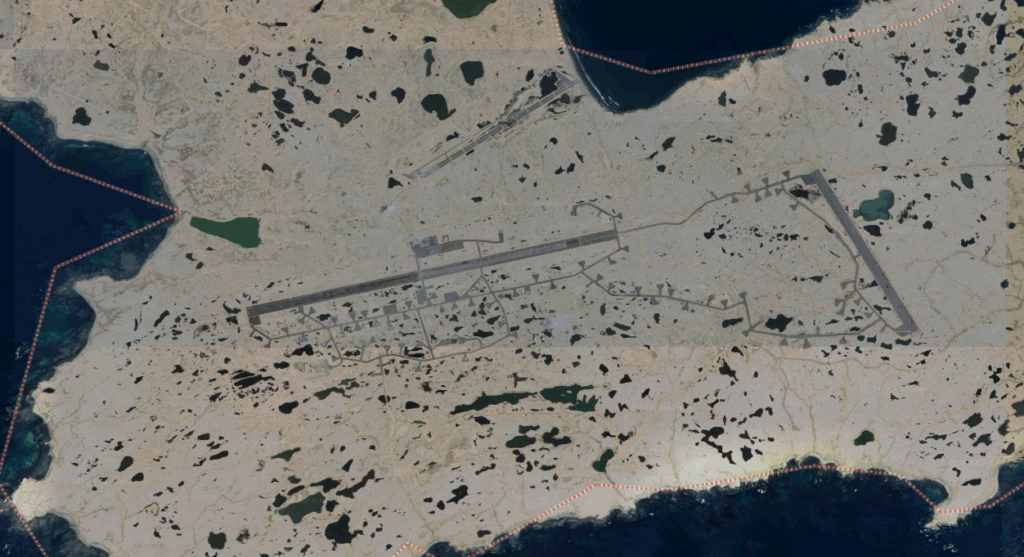
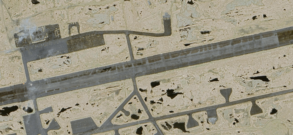
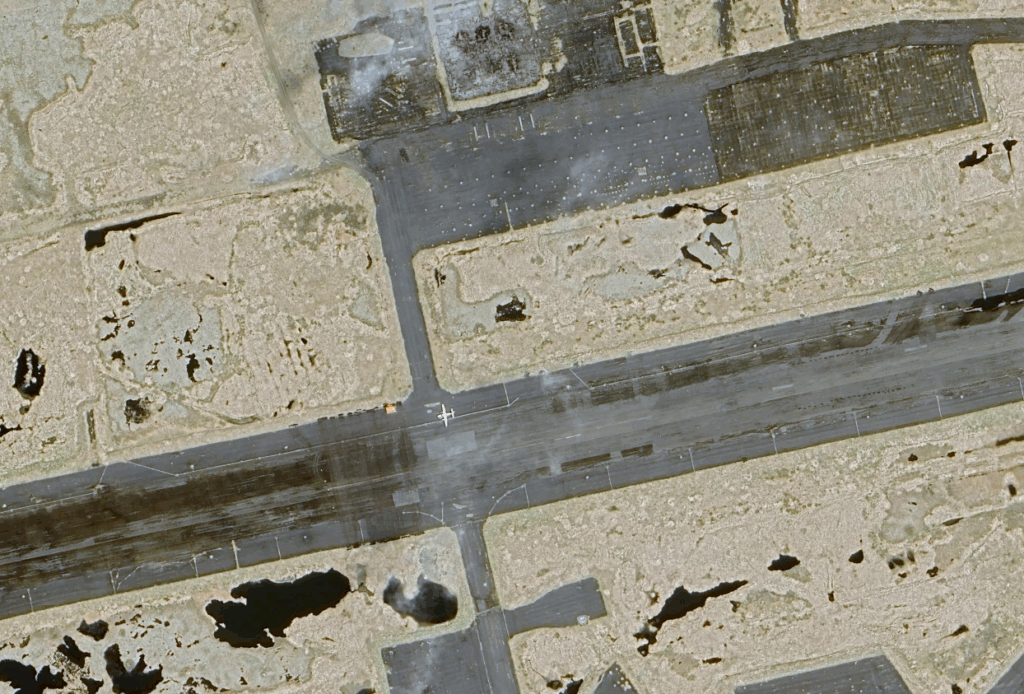
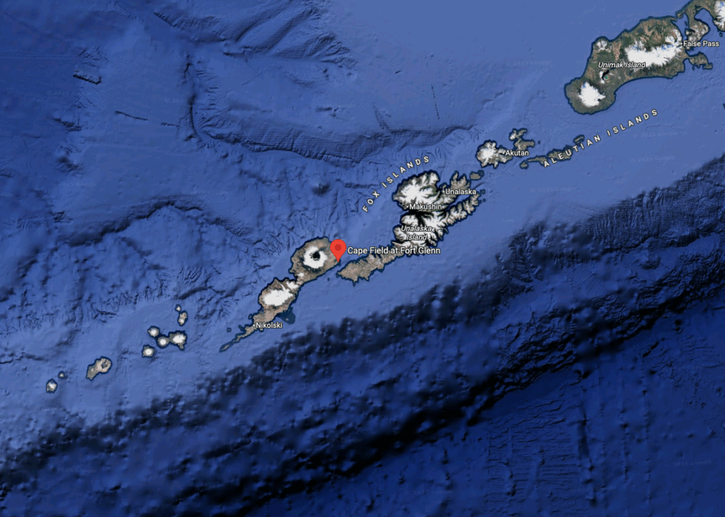
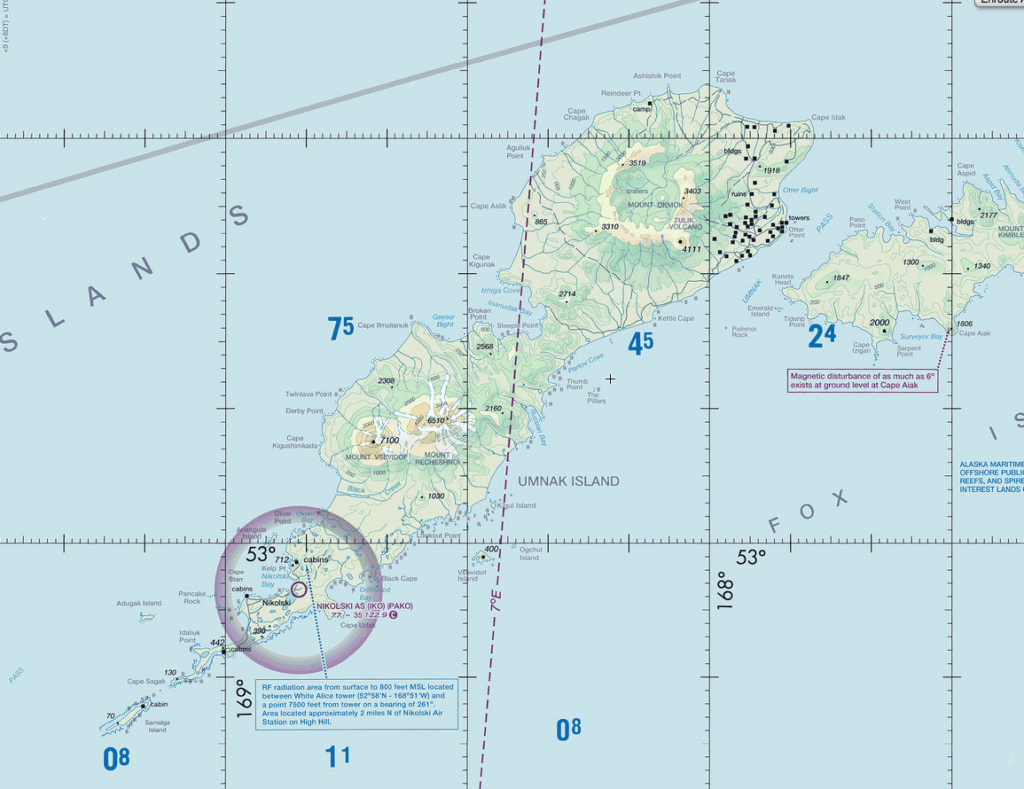
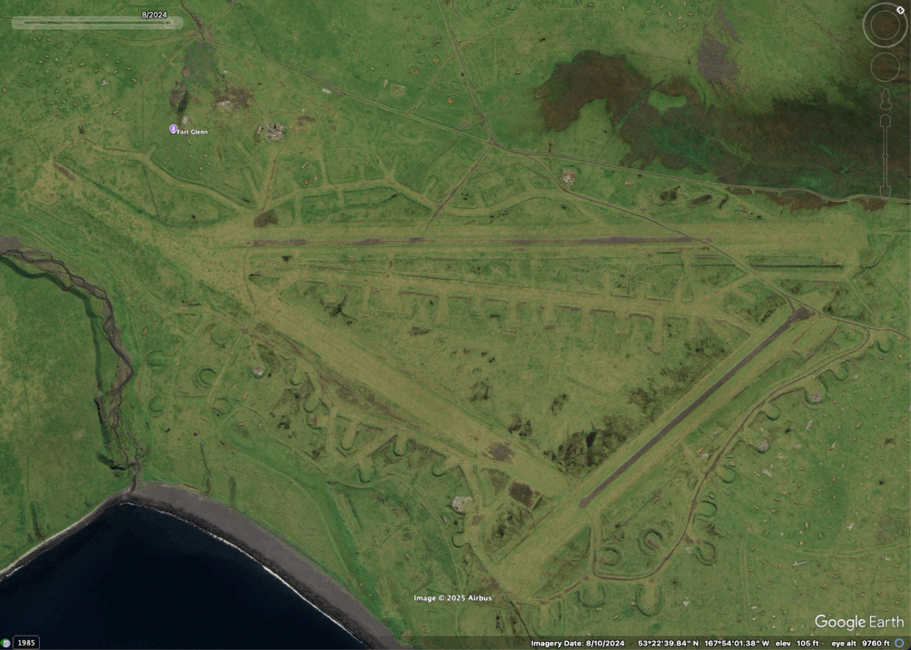
Umnak Island – Fort Glenn Army Airfield / Otter Point Naval Air Facility
Umank Island also has a WW2 history and has reportedly been most recently used as a cattle ranch. Fences and corrals are visible in the 2024 satellite images.
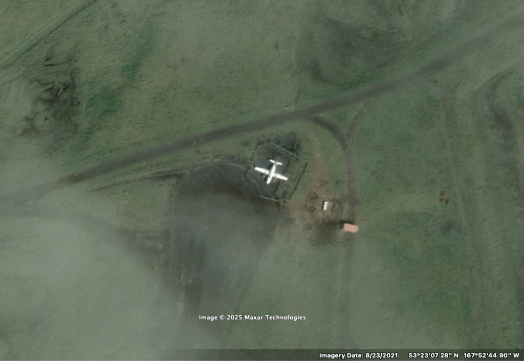
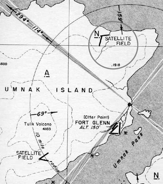
Umnak Island is in the Fox Island group and close to Unalaska and Dutch Harbor. No trace of the former air station is visible in this October 2025 FAA chart. The chart depicts ruins and other buildings at the site, visible here at the northeast corner of the island. The runways are still visible in this 10 August 2024 satellite image of Fort Glenn. Note the runway at the southeast corner is still usable.A light twin is visible and clearly corralled in this 23 August 2021 photo at the north end of the runway. The Satellite Field located on the north side of the island opposite Ft. Glenn is still visible in the image below, however the author sees no trace of the satellite field to the west. Runways at Fort Glenn’s northern satellite field are still visible in this 10 August 2024 image.
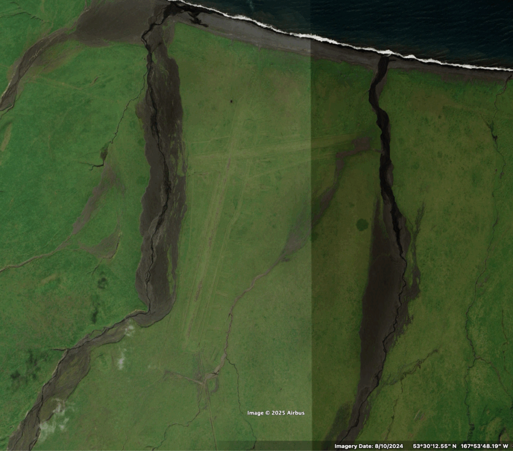
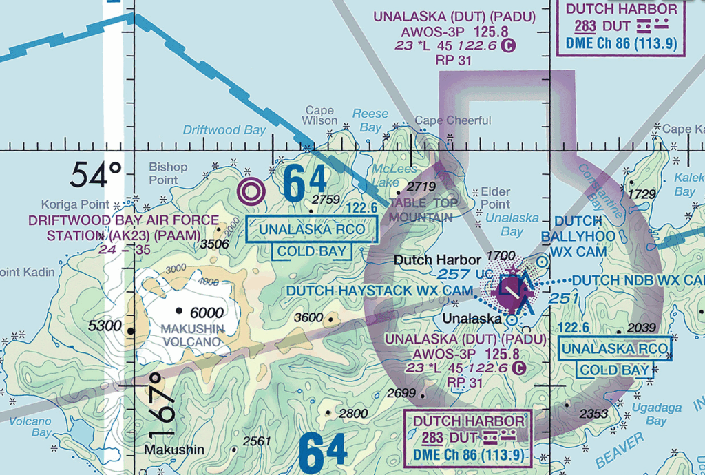
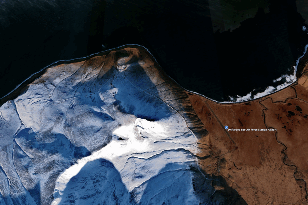
This is one of the only dirt airstrips at an “active” Air Force station or military base I’m aware of. Apparently it was established in 1958 to maintain an distant early warning line radar station just up the hill from the airport. The station was decommissioned in 1969, and restored to natural condition in 2000.
The double-ring depicts an “other than hard surfaced” runway at Driftwood Bay Air Force Station in this October 2025 FAA chart. The station served the long-range radar installations located on the road to the west of the station, covered here in light snow in this September 2019 image.
What an unbelievable corner of the planet to fly airplanes. With satellite communication, Wifi, and internet, I’m sure the Aleutians don’t feel as remote as they once did. I can’t imagine what the WW2 soldiers who were stationed at the “edge” of the planet must have been feeling – in the middle of a world war, constant fear of being attacked, and thousands of miles from their families. War IS hell. I hope I never see it.


The photo of the Goose on Akutan is so cool!
I love all the history you find, my love <3