In October 2022, I flew out to Seiku, Washington on the OP to pick up my friends Will and Aly for a visit and to collect some Fly Washington Passport stamps from Seiku, Quillayute, and Forks airports. It was a great day!
Sekiu (11S)
Departed Boeing Field (BFI), King County International Airport, and headed via Port Angeles to Sekiu, Washington, a very small village at the northwest corner of Washington state (The lamest state).
Unfortunately, no matter how high I climbed over the sound, I couldn’t escape the blanket of thick wildlife smoke covering the region. Yeeeech!
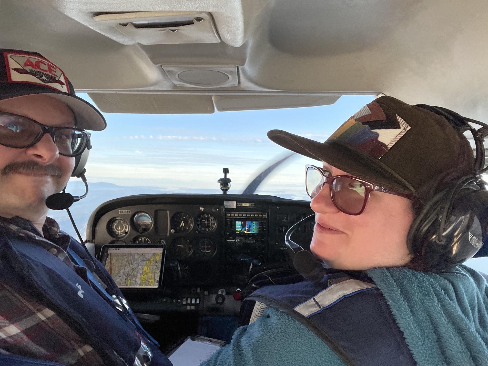
My first trip in a plane to the Olympic Peninsula, I studied YouTube videos in advance, which greatly supplement the usual method of looking at Sectional aviation maps and Airport Facility directories. Needless to say, between that and my moving map on my phone, showing precisely my position with its built-in GPS, I was all set for my arrival and made a flawless approach, entering a left downwind for runway 08, descending between the trees on short final to an up-sloping runway; always a situation where you’re on your toes!
Will and Aly, who live in Sekiu and Clallam Bay, picked me up and we got brunch at By the Bay Cafe. With nearly full tanks, I calculated our weight/balance and takeoff distance twice to ensure we were within my personal comfort zone, and departed downhill on runway 26 and headed over Wills house and on to Neah Bay, where they both pointed out their workplaces in the sleepy Makkah village.
Next we flew over Cape Flattery, the NW point of the lower 48 states, and Tatoosh Island and Cape Flattery Lighthouse. This is the south side of where the Strait of Juan deFuca meets the Pacific Ocean, where all ships headed to Seattle, Vancouver, and other points in the Salish Sea converge. The horizon on the Pacific is smooth and infinite. We escaped most of the smoke.
Quillayute (QIL)
Headed south down the beach at the minimum altitude of 2000 feet due to the designated Marine Sanctuary, we head to Quillayute (QIL), an abandoned military airfield from WW2, which still contains some original structures including a hangar and admin building which currently houses a NOAA weather station.
This airfield housed dirigibles and trainer aircraft. The concrete apron is unchanged for nearly 80 years!! We got the requisite Fly Washington Passport Stamp and peek in the windows of the admin building. Inside are desks that must weigh 200 pounds, used but unmoved in all this time. We can see abandoned workstations, including computers that appear to be from the 90s, and now appears to be a single desk with a modern computer. A museum of sorts that is a visual timeline from the 1940s to present day. The work of perhaps a dozen computer reduced to a single consumer grade computer. Fascinating
Forks (S18)
Next, we made the very short hop over to Forks (S18) and made a long straight in to Runway 04, which is sometimes used as a drag strip! Here we just hopped out long enough to grab a stamp, survey the best departure, and away we went – flying low over the city of Forks on the departure, as there were less trees via that direction.
Return via Jefferson County International (0S9)
Leaving Forks we flew a direct route and entered a right downwind for runway 26 this time. After some goodbyes I opted for an uphill departure after watching a club Cessna 150 depart and alight far sooner than I expected. For me as well, even with the slight uphill I left the surly bonds while Will filmed me from below, straight out over Cllalam Bay and direct to Jeff Co.
The Spruce Goose Cafe at Jeff Co is a locals favorite. I got there in time to get a burger and fries and take a photo of an old friend, a club plane (N738EP) that has sat on the tarmac for over a year awaiting a new engine and annual after a prop strike. Katt and I got my Passport book and stamp in Auburn in Seven Echo Papa and I don’t think I’ve flown it since. From here it was direct back to BFI, and other than the smoke it was a fantastic trip!!