Here’s some of the various and interesting seaplane bases (SPB) from FAA aeronautical charts that I found while working to get my ASES rating this year. I’m a total map nerd and can spend hours looking at maps. I’d love to develop this type of page into training materials that CFIs could use for seaplane applicants or flight reviews. Mastery of aeronautical chart terms and symbols is part of being a great pilot.
Core competencies for SPB chart knowledge:
Seaplane base symbols are depicted on aeronautic charts as anchors;
The symbol color, hatch marks, and rotating beacon symbols are the same as land bases;
When depicting a seaplane base, the eye of the anchor symbol will be charted as close to the docking area as possible, with the remainder of the symbol in the water.
NOTE TO SELF: DO ASES training materials page with CFRs, links to Seaplane guide, core concepts, performance standards etc
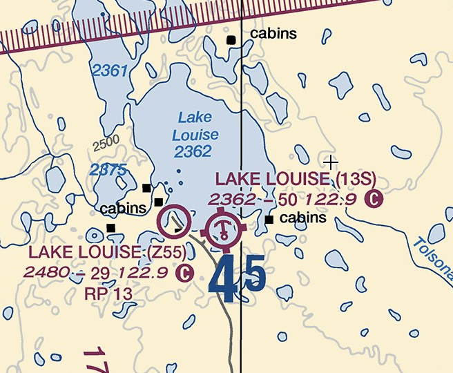
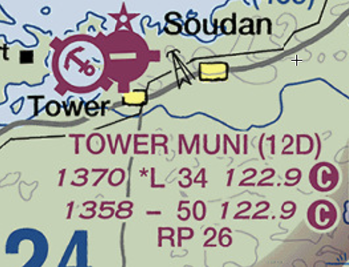
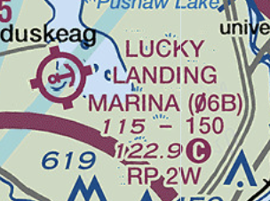
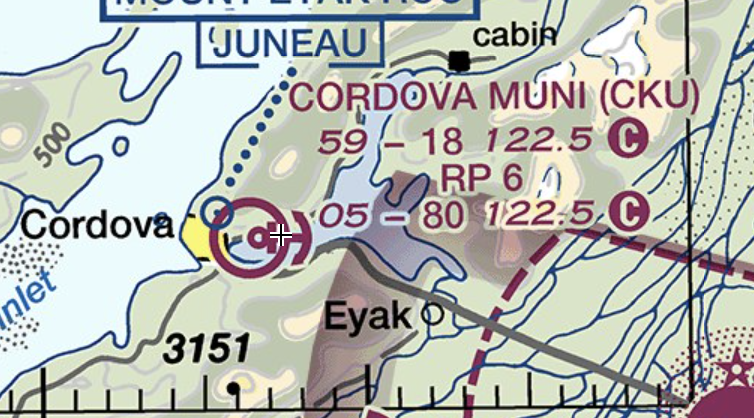
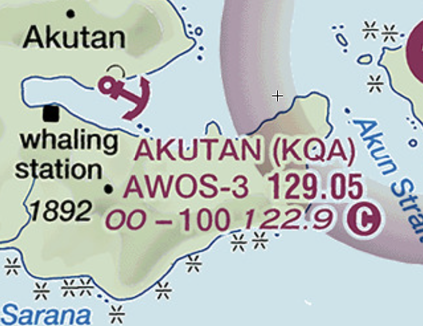
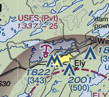
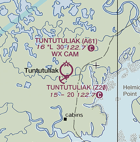
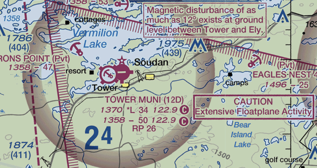
Lake Louise’s airbases are not co-located and have different airport IDs. Note the dash between the airport elevation and the longest runway length. Per the Aeronautical Chart User’s Guide, “When information is lacking. the respective character is replaced by a dash.” In this case, the availability of runway lighting “L” or “*L” is missing. Interestingly it applies to the seaplane base, which doesn’t make sense and I should consider opening an aeronautical inquiry to fix it. Tower Muni near the Boundary Waters Canoe Wilderness of northern Minnesota is a co-located Class E airport.Lucky Landing Marina SPB (06B), Bangor, MaineLong Lake SPB (9SB), Sinclair, MaineCordova Muni (CKU) co-located SPB. Note lack of services (tick marks) or beacon (star). Akutan (KQA) seaplane base near a whaling station in the Aleutians. The USFS base in Ely, Minnesota. Holy crap does that place have a history! There’s “a book or two” about the Boundary Waters Canoe Wilderness of northern MinnesotaTuntutuliak (A61) is a co-located airport with separate airport IDs. Satellite image suggests the SPB is the dock at the end of the runway, and is supported by the symbology above. CAUTION Extensive Floatplane Activity – northern Minnesota is a great place for seaplanes!
Class D seaplane bases
Here’s some selected US seaplane bases that lie within Class Delta airspace and are co-located with a “land” airport. Note the subtle differences in chart symbology, especially the beacon (star) label.
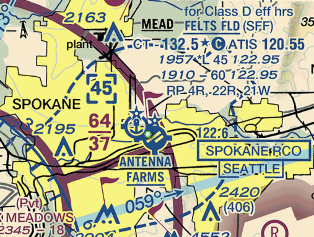
Felts Field (SFF) in Spokane has a co-located airport and seaplane base. Note that this is a Class Delta SPB and there is a beacon for both the land and sea areas. Note the information for the runways can be deduced as the land runwa that y shows “*L” for runway lighting.
Learning opportunities for Felts Field:
co-located waterway and runway aerodromes
Class Delta airspace (blue)
services (hatch marks)
rotating beacons from dusk until dawn (star symbols)
deductive reasoning for which runway data is for the waterway: the hard-surface runway data shows *L for lighted runways and therefore is not the waterway data. In addition, the hard-surface runway elevation of 1957 is 47 feet higher than the waterway at 1910, however this is not an absolute/foolproof method
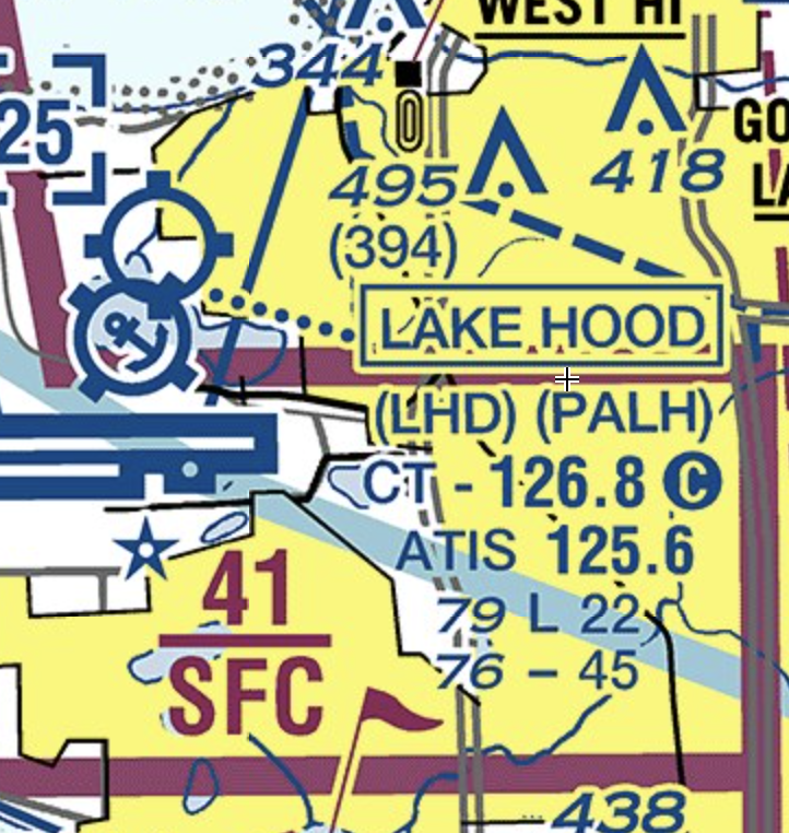
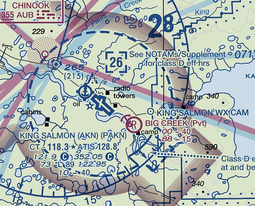
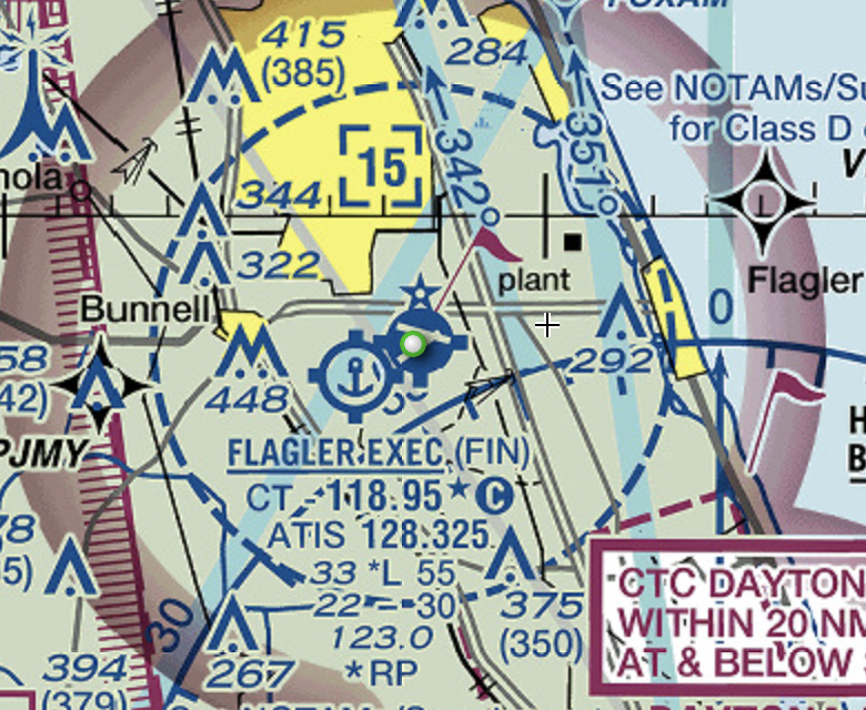
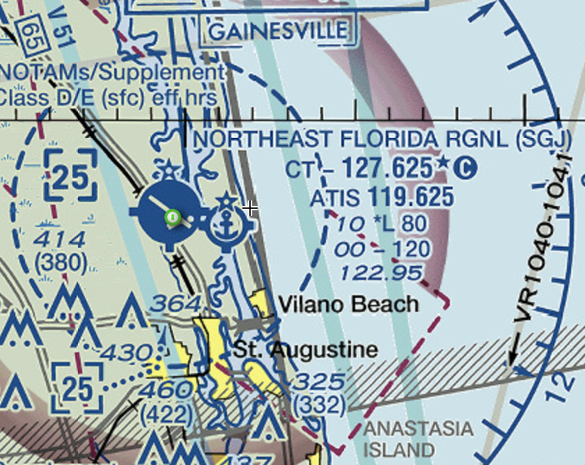
Lake Hood SPB (LHD) in Anchorage is widely considered to be the busiest seaplane base in the world. Note the airport is Class D, is co-located with a soft-field runway, does not have a rotating beacon and is separate but immediately adjacent to Anchorage International (ANC). King Salmon SPB (AKN) is another co-located Class Delta SPB. Note that Big Creek airport is a privately held co-located soft-field and SPB as well. Alaska is the place for this! Flagler Exec SPB (FIN) in Florida is co-located. Note here that the SPB does not indicate presence of a rotating beacon. Northeast Florida Regional SPB (SGJ) is also co-located with a hard-surface airport. Note Class D, lighted beacons, and listings for both sets of runways.
Unique and interesting SPBs
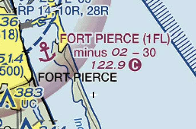
Fort Pierce SPB in Florida is listed as “minus 02” aka 2 feet below mean sea level behind a barrier island on the Atlantic coast. The author could find no evidence of this base anywhere on Google Earth. Note the eye is in the middle of the “Indian River.”
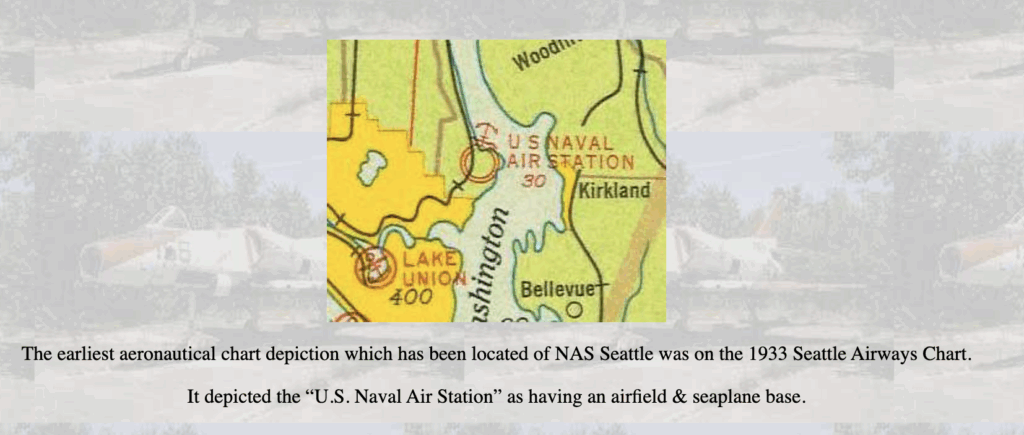
Military seaplane bases
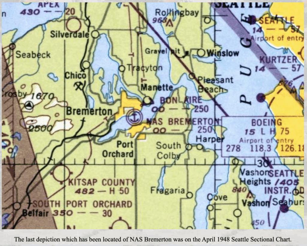
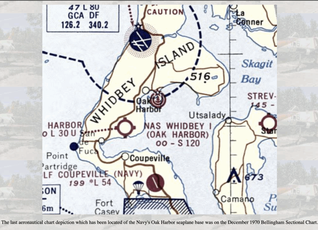
In 2025, there are no currently active military seaplane bases, but they are significant part of our history, especially in the PNW. Here are some former PNW-area military seaplane bases.
This screen grab of Naval Air Station Bremerton shows the double-ring around the anchor marking, depicting a military seaplane base, of which there are no longer any active in the United States as of 2025. The base is long gone but there’s still a shipyard where old aircraft carriers go to die, among other things. Click on the photo to read more about this closed base on Paul Freeman’s excellent site Abandoned & Lesser-known Airfields. This screen grab of Oak Harbor Naval Seaplane Base on Whidbey Island shows the double-ring marker as well. The ramps for this base are still intact and the hanger is now the Navy Exchange building. Somewhere I read that recently for an anniversary a PBY Catalina drove up the ramp for the celebration. Click on the photo to read more about this closed base on Paul Freeman’s excellent site Abandoned & Lesser-known Airfields.This final screen grab depicting the double-ring and anchor of the seaplane base when Sandpoint was a Naval Air Station Seattle seaplane base, which preceded the development of the runways. The area is now Magnuson Park. Click on the photo to read more about this closed base on Paul Freeman’s excellent site Abandoned & Lesser-known airfields.